
Giro delle Acque di Sassofeltrio e via dei Borromeo

Discover
Beauty Nature Excursions Sport A piedi Cycling Tourism Hiking
OVER TITOLO

Giro delle Acque di Sassofeltrio e via dei Borromeo

The route is well-marked with CAI signs and directional arrows, making orientation fairly easy.
1 day
Bike tour
SpringAutumn
The route has a moderate difficulty, requiring good physical conditioning to handle the elevation changes. It is suitable for hikers accustomed to walking, and for mountain biking, it requires a fair level of technical skill to tackle the steeper and more panoramic sections.

The Water Circuit of Sassofeltrio and Via dei Borromeo represents one of the most scenic and panoramic routes in the Monte San Paolo area, crossing the territories of the municipalities of Monte Grimano Terme and Sassofeltrio. This route combines natural beauty, history, and breathtaking views of the entire valley.”

Monte Grimano Terme, the ideal starting point for the route, is a village in the Marche region located in the heart of Montefeltro, listed among the Most Beautiful Villages in Italy. The town is renowned for its sulfurous thermal baths, which have been a source of wellness and natural health since the 15th century. Sassofeltrio, perched on a cliff at an altitude of about 466 meters, overlooks the Val Conca with spectacular views stretching from the Adriatic Sea to Mount Carpegna and Mount Titano. The village is known as the “Terrace of Montefeltro” for its exceptional panoramic vistas.

Summary table of the itinerary 

Feature Detail
Full Name Water Circuit of Sassofeltrio and Via dei Borromeo
Type Mixed route: trekking + mountain bike (MTB)
Trail status Open and accessible
Total length Approximately 10–13 km (depending on the variant)
Positive elevation gain Approximately 450–500 meters
Negative elevation gain Approximately 450–500 meters
Difficulty Medium (E – Hiking)
Estimated duration 4–5 hours (with breaks)
Minimum altitude Approximately 300–350 meters above sea level (Valle Sant’Anastasio)
Maximum altitude Approximately 800–860 meters above sea level (Monte San Paolo ridge)
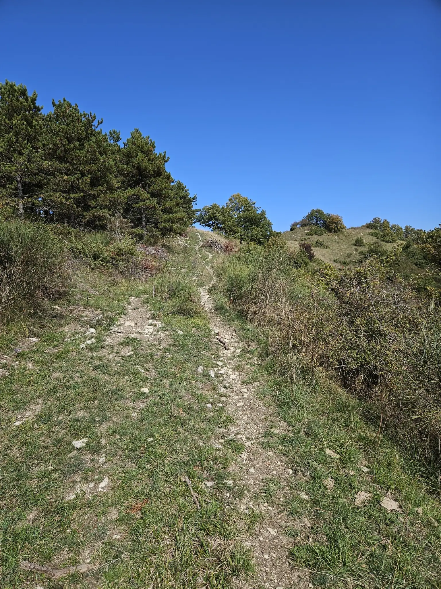
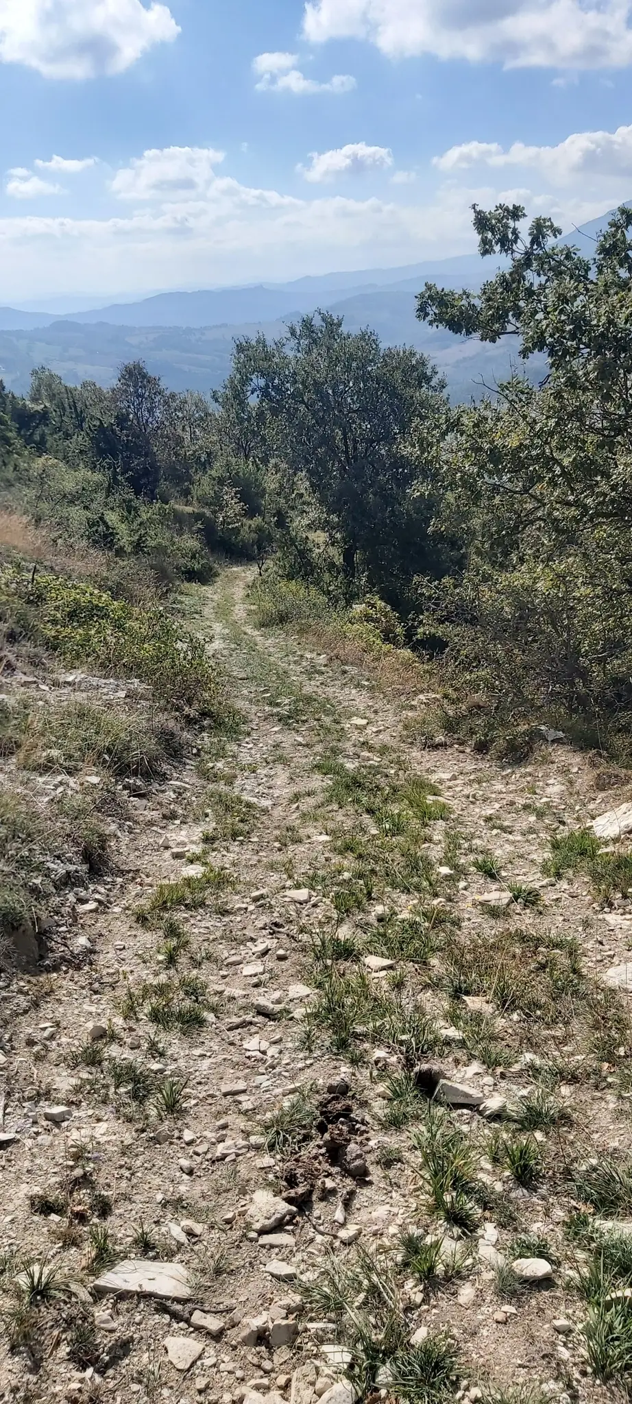
Main surface Trails, dirt roads, white roads
Recommended starting points Monte Grimano Terme (village) or Sassofeltrio (Valle Sant’Anastasio)
Main points of interest – Trail of Secrets
– Cippo of Garibaldi
– Sulfur Water Trail (Valle Sant’Anastasio)
– Via dei Borromeo (Monte San Paolo ridge)
– Cross of Monte San Paolo
– Views of Valconca and the Adriatic Coast
Trail accessibility Suitable for trained hikers and cyclists with good preparation; not recommended after recent rain due to muddy sections
Best period Spring (April–June) and Autumn (September–October)
Recommended equipment Trekking shoes or MTB, technical clothing, water, rain jacket, map or GPS track
Events related to the route Granfondo La Via dei Borromeo, Ride4Bronz, trekking organized by Bike-Advisor and Pro Loco

Offerta

Request your Experience at least 36 hours before your arrival. We will respond with all the availability, information, and service costs!" Go to this link: https://tdh.comune.montegrimanoterme.pu.it/interesse/avventura-su-due-ruote-pedalare-nel-cuore-panoramico-di-monte-grimano-terme/

Technical and Environmental Characteristics

Elevation and Distance
While precise data for the specific "Doppio Monte San Paolo" route may vary, based on connected trails we can estimate:

  • Total Ascent (Elevation Gain): approx. 500-600 meters
  • Length: approx. 12-15 km
  • Duration: 3-4 hours for trekking, approx. 2 hours by MTB

Environment
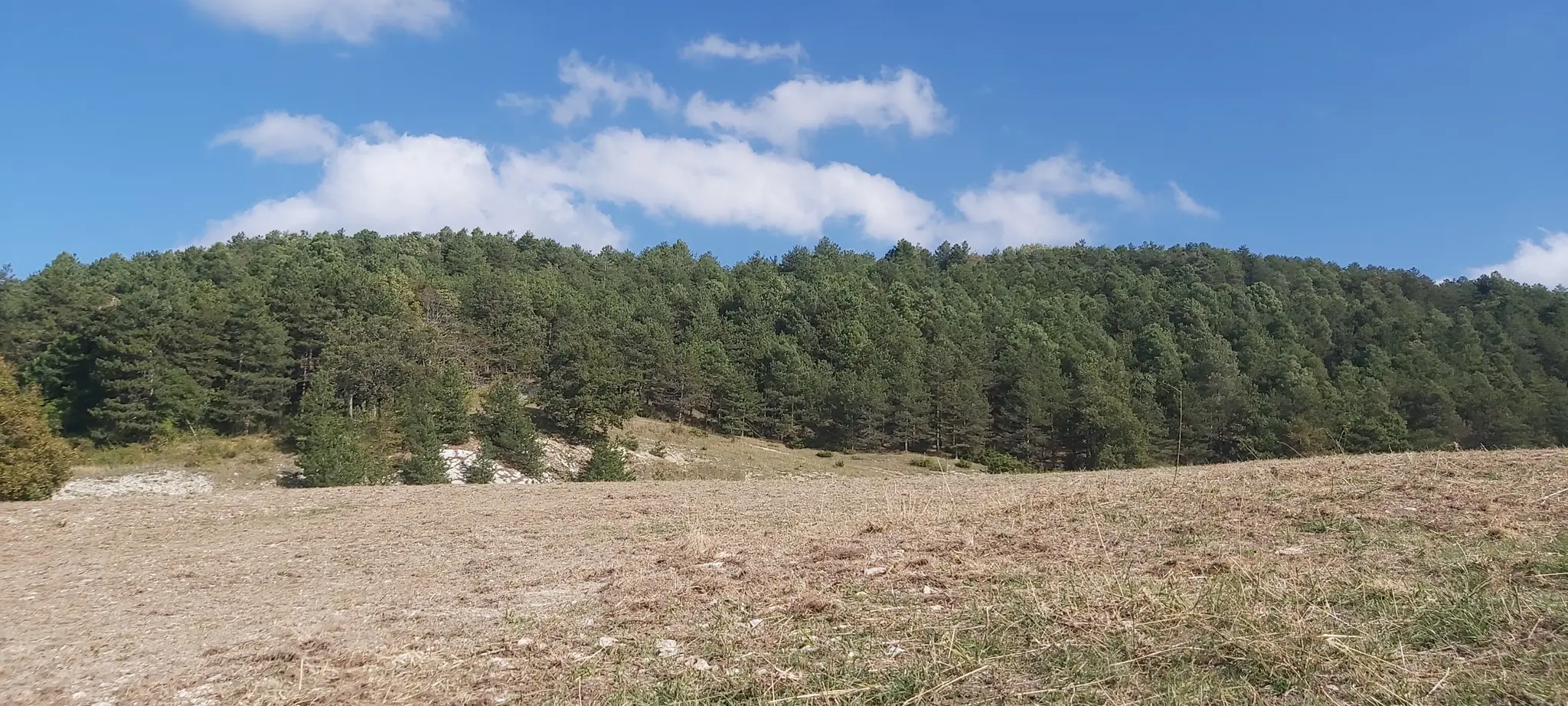
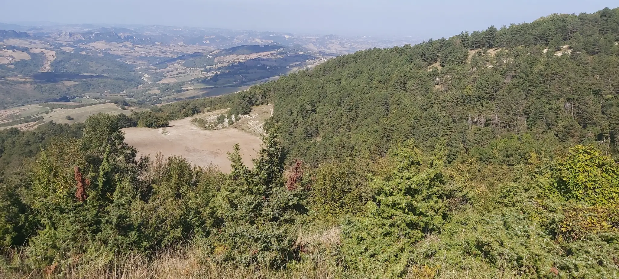
The route crosses a highly diverse landscape:

  • Chestnut and beech forests.
  • Open pastures of Mount San Paolo.
  • Scenic unpaved ridgelines.
  • Valley zones with riparian vegetation (Sant'Anastasio Valley).
  • Shaded woodland paths.

Trail Signage
The paths are marked with CAI (Italian Alpine Club) trail signs. They are part of the Monte Grimano Terme and Sassofeltrio trail network, which boasts a total of 75 km of cycling paths with 2,600 meters of total elevation gain.

Points of Interest

Historical

  • Garibaldi Memorial (Cippo di Garibaldi): A monument commemorating Giuseppe Garibaldi's passage in 1849.
  • Church of Suripe: An ancient church located along the trail.
  • Medieval Routes: Ancient communication paths dating back to the Middle Ages.

Naturalistic

  • Meleto Springs: Natural sources of sulfurous water.
  • Sant'Anastasio Valley: A valley characterized by the presence of sulfurous springs.
  • Mount San Paolo Pastures: High-altitude grazing lands (please ensure all gates are closed after passing).
  • Panoramic Views: Stunning vistas overlooking San Marino, the Adriatic coast, Valmarecchia, and the Montefeltro region.

Practical Information

Access
The main starting point is easily accessible from the center of Monte Grimano Terme, in Piazza Matteotti. For those wishing to access the "Sulphurous Waters Trail" from Sassofeltrio, the reference point is Ca' Micci in the Sant'Anastasio Valley.

Recommended Periods
The trail is accessible from spring to autumn. The best times to visit are March–May for the spring blooms and September–October for the autumn colors (foliage).

Recommendations

  • Fitness: A good level of physical training is required due to the elevation gain and distance.
  • Pasture Gates: Always close gates behind you to respect local livestock.
  • Safety: Always follow the official CAI signage.
  • Water: Carry sufficient water, especially during the summer months.

Connection with Other Routes

The "Doppio Monte San Paolo" can be combined with other local itineraries:

  • Village Loop (Giro del Borgo): A short route around the village of Monte Grimano Terme.
  • Sassofeltrio Water Loop & Borromeo Way: Itineraries passing through the "Path of Secrets" and the Sassofeltrio waters.
  • Magic Montefeltro (19 km, 600m ascent): A circular route including parts of the Mount San Paolo trails.

This itinerary is part of the trail system promoted by Bike-Advisor and Leurini Trail, highlighted through events such as the Granfondo La Via dei Borromeo and Ride4Bronz.

Giro delle Acque di Sassofeltrio e via dei Borromeo
Sentieri e Panorami lungo il percorso

Route map

1

Path of Secrets

Path of Secrets
Path of Secrets: An ancient connecting route that has been restored and enhanced with panels and tourist information, considered one of the "must-do" hiking trails in the Monte Grimano Terme area. From the Seriole area, the trail leads into the forest up to the Garibaldi Monument on Mount San Paolo. Ideal for both hiking and mountain biking, both uphill and downhill.  
2

Sulfur Water Trail of Sassofeltrio

From the Cross, the itinerary continues along the Sulfur Water Trail, which runs through Valle Sant’Anastasio in the territory of Sassofeltrio. This scenic route offers breathtaking views of the Valmarecchia and Mount San Paolo itself. The trail is classified as CAI 060 and winds through an unspoiled natural environment.
3

THE BORROMEO WAY

​The Borromeo Way represents one of the most fascinating historical and naturalistic routes in the Montefeltro area, stretching mainly along the ridge of Mount San Paolo between the municipalities of Monte Grimano Terme and Sassofeltrio. This ancient communication route is now enhanced as a privileged itinerary for trekking and mountain biking, offering a unique experience where history, nature, and sport come together in perfect harmony. Historical Origin of the Name The name 'Via dei Borromeo' refers to the ancient communication route that crossed the Montefeltro area during the medieval period. Although historical sources specifically linking the Borromeo family to this region are limited, the toponym suggests a connection to the old transit routes used by noble families and pilgrims traveling through these lands between the Marche and Romagna regions. The Borromeo family was one of the most important noble families in Italy, originally from the Lombardy region, who by the 14th century acquired vast estates and possessions. The family gained significant prestige under Vitaliano I Borromeo (1390-1449), who obtained the fief of Arona in 1439 and considerably expanded the family’s domains. Among the most illustrious members of the family is Saint Charles Borromeo (1538-1584), cardinal and archbishop of Milan, a central figure in the Counter-Reformation. The presence of the name 'Borromeo' associated with this route in Montefeltro may refer to the historical connections between different Italian regions through ancient medieval communication routes, used for commercial, military, and religious purposes. The Montefeltro area, in fact, was traversed by important pathways that linked Romagna to the Marche region and the Apennine hinterland.ninico.​ Features of the Route ROUTES - Monte Grimano Terme The Borromeo Way mainly runs along the ridge of Mount San Paolo, reaching an altitude of 864 meters at the summit. The trail offers exceptional panoramic views of the Valconca valley, the Adriatic coast, San Marino, and, on clear days, even the Croatian coast. The historical route of the Borromeo Way covers over 20 kilometers of the original ancient path, crossing three historic medieval villages: Monte Grimano Terme, Montecerignone, and Monte Tassi. These ancient settlements are important historical landmarks of the Montefeltro area, a region once contested between the powerful Malatesta and Montefeltro families during the Middle Ages. Technical features of the trail: Trail surface: The terrain consists of approximately 40% gravel, 40% dirt road, and 20% asphalt. Type: Ridge trails, white roads (strade bianche), and historic mule tracks. Accessibility: 100%, the trail is fully accessible. Vegetation: The route passes through oak forests, pastures, and areas of Mediterranean scrub. Topography: The trail winds along the ridge with continuous ascents and descents, offering a variety of landscapes and technical challenges. Events and Celebrations ​​The Borromeo Way has also become famous thanks to the numerous sports events that use it as the main route. The name has been well-known since 2015, when it was first used in the Granfondo of Monte Grimano Terme, and since then it has become a regular event for mountain bike and cycling tourism enthusiasts." Granfondo La Via dei Borromeo: an annual event held in Monte Grimano Terme, usually in May. The event includes: Competitive route of 42 km Short route of 25 km for cycling tourists Guided family ride of about 15 km The event is part of the Italian SUPERSIX Race national circuit and the Caveja Bike Cup Regional Championship, representing an important occasion for Italian off-road cycling. MAGIC Montefeltro Sport Week: The Granfondo La Via dei Borromeo is the final event of a week dedicated to sports and nature, involving various disciplines such as soccer, trekking, horseback riding, padel, and beach volleyball. Ride4Bronz: A charity event that includes a 30 km MTB route with 1,000 meters of elevation gain, crossing the territories of Monte Grimano and Sassofeltrio. Marche and Romagna.